Posts

You Will Never Guess What This Senate Hopeful Blamed for East Coast Earthquake

A candidate running for Senate in New Jersey attributed Friday’s east coast earthquake to climate change.

Christina Khalil, who is running for a Senate seat in New Jersey as a member of the Green Party, blamed the “climate crisis” for the unusual magnitude 4.8 earthquake that struck her state and several others bordering it on Friday. Khalil is hoping to take the seat currently occupied by longtime Democratic New Jersey Sen. Robert Menendez, who now faces numerous charges related to alleged bribery schemes involving Qatar and Egypt. . .

While Khalil suggests that climate change is responsible for the tremor, the National Aeronautics and Space Administration (NASA) rejects that there is any connection between climate conditions and seismic activity.

“With the advent of seismology — the study of earthquakes — we now know that most quakes are caused by tectonic processes — forces within the solid Earth that drive changes in the structure of Earth’s crust, primarily the rupture of underground rock masses along faults,” according to Alan Buis of NASA’s Jet Propulsion Laboratory. “We also know that most earthquakes occur far beneath Earth’s surface, well beyond the influence of surface temperatures and conditions. Finally, we know the statistical distribution of earthquakes is approximately equal across all types of weather conditions. Myth busted.” (Read more from “You Will Never Guess What This Senate Hopeful Blamed for East Coast Earthquake” HERE)

Turkey, Syria Hit by New 6.4-Magnitude Earthquake 2 Weeks After Twin Quakes Killed at Least 46,000

A powerful 6.4 magnitude earthquake struck Turkey near the Syrian border late Monday — two weeks after twin earthquakes devastated the region, killing at least 46,000 people and leaving millions of people homeless.

The quake — almost as forceful as the 7.8 and 7.5 magnitude earthquakes that struck on Feb. 6, leaving Turkey and Syria under piles of rubble — brought further heartbreak and despair to the already ravaged Hatay province in southern Turkey.

Its tremors were centered around the town of Defne, in Hatay province, Turkey’s disaster management agency AFAD said — but was also strongly felt in the cities of Antakya and Adana, located to the north.

Antakya resident Muna Al Omar — who, like many in the city, is already living in a temporary housing shelter — said she was in a tent in a park when disaster struck again.

“I thought the earth was going to split open under my feet,” she said through tears while holding her 7-year-old son in her arms. “Is there going to be another aftershock?” (Read more from “Turkey, Syria Hit by New 6.4-Magnitude Earthquake 2 Weeks After Twin Quakes Killed at Least 46,000” HERE)

Delete Facebook, Delete Twitter, Follow Restoring Liberty and Joe Miller at gab HERE.

Haiti Struck With Devastating Earthquake; Nearly 1,300 Dead

The Haitian government declared a state of emergency after a 7.2-magnitude earthquake struck the country Saturday, leaving at least 1,297 people dead and more than 5,700 injured, according to the country’s civil protection agency.

Of the 1,297 fatalities, 1,054 are in the South administrative region, 119 are in Grand’Anse, 122 are in Nippes and two are in the Northwest region, the civil protection service reported on Sunday.

The quake destroyed 13,694 homes and damaged another 13,785, officials from the agency said. The destruction has also pushed hospitals to the brink and blocked roads that would carry vital supplies.

“When it comes to medical needs, this is our biggest urgency. We have started to send medications and medical personnel to the facilities that are affected,” Prime Minister Ariel Henry said. “For the people who need urgent special care, we have evacuated a certain number of them, and we will evacuate some more today and tomorrow.” (Read more from “Haiti Struck With Devastating Earthquake; Nearly 1,300 Dead” HERE)

Delete Facebook, Delete Twitter, Follow Restoring Liberty and Joe Miller at gab HERE.

Pacific Tsunami Warnings Lifted After 8.2-Magnitude Earthquake Hits Alaska

Tsunami warnings were lifted for Alaska and the rest of Pacific after a huge earthquake of 8.2 magnitude struck the seismically active U.S. state in the late hours Wednesday.

In Alaska, small tsunami waves measuring under a foot above tide level were observed in Sand Point, Old Harbor, King Cove, Kodiak, Unalaska and Alitak Bay, according to the US National Tsunami Warning Center (NTWC).

There were no immediate reports of injuries or damage to property. Several Alaskan coastal communities were evacuated following the quake. Among them was Seward on the Kenai Peninsula, south of Anchorage, where sirens blared and residents were told to move to higher ground.

The US Geological Survey (USGS) said the quake, which struck at 10:15 p.m. local time, was at a depth of 35 km (21.7 miles). It struck about 91 km east-southeast of Perryville, about 800 km (500 miles) from Anchorage, Alaska’s biggest city.

(Read more from “Pacific Tsunami Warnings Lifted After 8.2-Magnitude Earthquake Hits Alaska” HERE)

Delete Facebook, Delete Twitter, Follow Restoring Liberty and Joe Miller at gab HERE.

Powerful Earthquake Rattles Alaska

A powerful magnitude 6.1 earthquake shook Alaska on Sunday evening, according to officials.

The quake hit just before 11 p.m. local time from an epicenter under the Talkeetna Mountains in the Matanuska-Susitna Borough, according to the U.S. Geological Survey (USGS). The temblor originated at a depth of 27 miles.

The epicenter was about 45 miles south of Chickaloon and 55 miles north of Sutton, according to the USGS and Alaska Earthquake Center.

Residents felt the quake from as far south as Homer to Fairbanks in the north – about a 580-mile range, the Anchorage Daily News reported. Many residents felt the earth rumble 100 miles away in Anchorage. (Read more from “Powerful Earthquake Rattles Alaska ” HERE)

Delete Facebook, Delete Twitter, Follow Restoring Liberty and Joe Miller at gab HERE.

Yellowstone Approaches Record Levels of Seismic Activity

By now, most are aware of the earthquake swarm under the Yellowstone supervolcano. Many people are fearing a major eruption, and those terrors aren’t calmed for some as the national park approaches a record number of earthquakes.

A cluster of earthquakes at the Yellowstone Park volcano is the most active it’s been in recent history. The earthquake count is up to 2,357 since June with the largest having a magnitude of 4.4. The majority of the earthquakes were magnitudes of 0 or 1, according to a report by Newsweek.

Yet scientists are assuring the public that a swarm of earthquakes doesn’t necessarily signal an eruption of the supervolcano. But when the type of earthquakes occurring in Yellowstone deviates from the standard, it could mean that an eruption is forthcoming. A swarm of earthquakes is rather normal for Yellowstone, but the number of quakes is approaching a new record.

The current swarm is approaching the record set in 1985 when three months brought over 3,000 earthquakes. In 2010 a swarm brought over 2,000 earthquakes over a month. Scientists still say to not worry too much. The threat of an eruption is still very slim.

The current situation doesn’t present too much of an eruption threat. The geological pressure would have to be sizable for anything to occur. “Yellowstone has had dozens of these sorts of earthquake swarms in the last 150 years it’s been visited. The last volcanic eruption within the caldera [crater] was 70,000 years ago. For magma to reach the surface, a new vent needs to be created, which requires a lot of intense geological activity,” said Jacob Lowenstern, one of the scientists managing the Yellowstone Volcano Observatory. –The Epoch Times

Lowenstern went on to say that the odds are very high that Yellowstone will go centuries more without an eruption and that if one does occur, it will be minor. Should these earthquakes lead to an eruption, scientists think it would not be of much consequence. “If Yellowstone erupts, it’s most likely to be a lava flow, as occurred in nearly all the 80 eruptions since the last ‘supereruption’ 640,000 years ago. A lava flow would be a big deal at Yellowstone, but would have very little regional or continental effect,” Lowenstern explained. (For more from the author of “Yellowstone Approaches Record Levels of Seismic Activity” please click HERE)

Follow Joe Miller on Twitter HERE and Facebook HERE.

The Earth’s Crust Will Be Shaken by More Than 100,000 Earthquakes That Humans Can Feel in 2016

Did you know that our planet will be hit by more than 100,000 earthquakes of magnitude 3.0 or greater this year alone? Earlier today, I came across a report that contained this amazing fact, but it was so incredible that I felt that I had to go and verify it myself. So I went to the official USGS website, and I found out that this is actually true. Overall, there are about half a million earthquakes around the globe each year, but it is only when a quake is of about magnitude 3.0 or greater that humans actually feel them. As the very large earthquakes in Italy and Myanmar within the last 24 hours have demonstrated, the shaking of our planet is getting worse, and this is something that I have written about over and over again. So why is this happening? Why does the crust of our planet seemingly become more and more unstable with each passing year?

We need to start addressing those questions, because there aren’t too many things that can do more damage to a community than a major earthquake. Very early Wednesday morning, a magnitude 6.2 earthquake struck central Italy. It is being reported that it sounded “like a bomb” went off, and it looks like this is going to end up being the worst natural disaster to hit Italy in many years.

This earthquake rattled buildings in Rome, it could be felt in Naples to the south, and it is even being claimed that it could be felt all the way up in Bologna in the north.

The epicenter of the quake was a charming little Italian town known as Amatrice. According to Mayor Sergio Pirozzi, “the town is no more” at this point. You can see some amazing photographs of the destruction for yourself right here. Homes, churches and businesses collapsed in heaps of rubble, and at this moment rescuers are engaged in a frantic race against time to pull survivors from the wreckage…

Rescue teams using bulldozers, and aided by townspeople with their bare hands, were still poring through the piles of rock, metal and wood late Wednesday looking for possible survivors. Police near the town of Ascoli said they could hear cries for help from under the rubble but lacked the heavy equipment to move the rocks, according the RAI radio.

“We need chain saws, shears to cut iron bars, and jacks to remove beams: everything, we need everything,” civil protection worker Andrea Gentili told the Associated Press.

So far, the death toll stands at 159 people, but that number is going to go way up as more bodies are discovered. The following was reported by Reuters…

One hotel that collapsed in the small town of Amatrice probably had about 70 guests, and only seven bodies had so far been recovered, said the mayor of the town that was one of the worst hit by the quake.

But as destructive as the Italian quake was, it wasn’t even the largest earthquake on the globe on Wednesday. A huge magnitude 6.8 earthquake struck Myanmar, but because that earthquake was much deeper it didn’t do the same level of damage as the quake in Italy did…

A powerful earthquake shook Myanmar on Wednesday, killing at least three people and damaging nearly a hundred ancient Buddhist pagodas in the former capital of Bagan, a major tourist site, officials said.

The U.S. Geological Survey said the magnitude 6.8 quake was centered about 25 kilometers (15 miles) west of Chauk, a town south of Bagan. It was located fairly far below the Earth’s surface at a depth of about 84 kilometers (52 miles), it said.

Sadly, most Americans couldn’t care less about what goes on in places like Italy or Myanmar. I know that may sound terrible, but it is true.

However, Americans should care, because this global rise in earthquake activity is affecting us as well. In fact, the USGS now says that human activity may at least be partially to blame for the “dramatic increase in seismicity” that we have been witnessing in the United States in recent years…

On Monday, for the first time, the U.S. Geological Survey has released an analysis of the magnitude of “human-induced” earthquakes. That such a thing as human-induced earthquakes can exist is scary enough, but the “dramatic increase in seismicity” in places such as Oklahoma has forced the USGS to consider the threat more broadly.

“By including human-induced events, our assessment of earthquake hazards has significantly increased in parts of the U.S.,” said Mark Petersen, chief of the USGS National Seismic Hazard Mapping Project, in a statement. “This research also shows that much more of the nation faces a significant chance of having damaging earthquakes over the next year, whether natural or human-induced.”

And I wanted to note that there was a magnitude 3.9 earthquake in Colorado on Tuesday. We have started to see sizable earthquakes in many portions of the country where they are not expected, and this is going to continue to get worse as the shaking of our planet intensifies.

There is one more thing that I wanted to share with you all today. I don’t know if this is related to anything, but a blood red moon was photographed directly behind the new World Trade Center tower last night. To some people this is just a meaningless coincidence, but there are others that consider it to be a very ominous sign.

This summer, things have been relatively calm and peaceful in America. Donald Trump and Hillary Clinton have dominated the headlines, but other than the election there really hasn’t been a major crisis that has grabbed the attention of the nation.

But of course all of that could change in a moment. Despite all of our advanced technology, the truth is that we are still virtually defenseless against a major natural disaster.

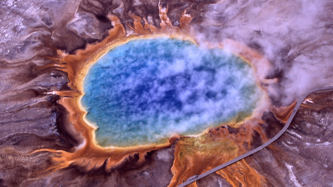
Scientists tell us that it is inevitable that a great New Madrid earthquake will shake the center of the country. They also tell us that it is inevitable that there will be a major earthquake in southern California, that volcanoes on the west coast will erupt again, and that the Yellowstone supervolcano could wipe out much of the country in a single day.

As global seismic activity continues to rise, it is just a matter of time before a string of historic disasters hits this nation.

Unfortunately, I am convinced that this could happen a lot sooner than most people would dare to imagine. (For more from the author of “The Earth’s Crust Will Be Shaken by More Than 100,000 Earthquakes That Humans Can Feel in 2016” please click HERE)

Follow Joe Miller on Twitter HERE and Facebook HERE.

Study Predicts Chance of 9+ Magnitude Mega-Earthquake in Alaska

There’s a nine percent chance a magnitude 9 or larger earthquake will strike the Aleutian Islands in the next 50 years. That is the prediction offered by scientists from the University of Hawai’i at Mānoa — made with the help of a newly designed computer model.

Researchers say an earthquake of that size could send a mega-tsunami in the direction of the Hawaiian Islands.

The Aleutian Islands, which stretch toward Russia from the coast of Alaska, sit along a subduction zone at the convergence of the Pacific and North American tectonic plates. Scientists say the chance of a dramatic slip along the fault lines that make up the subduction zone is significant.

They detailed the threat of a mega-earthquake in a new paper, published this week in the Journal of Geophysical Research – Solid Earth.

“Necessity is the mother of invention,” lead study author Rhett Butler, a geophysicist at the UHM School of Ocean and Earth Science and Technology, explained in a news release. “Having no recorded history of mega tsunamis in Hawai’i, and given the tsunami threat to Hawai’i, we devised a model for Magnitude 9 earthquake rates following upon the insightful work of David Burbidge and others.” (Read more from “Study Predicts Chance of 9+ Magnitude Mega-Earthquake in the Aleutians” please click HERE)

Follow Joe Miller on Twitter HERE and Facebook HERE.

Large-Scale Motion Detected Near San Andreas Fault System

Analysis of GPS data has revealed new areas of motion around the San Andreas Fault System.

Using data collected by the EarthScope Plate Boundary Observatory’s GPS array, researchers identified 125-mile-wide “lobes” of uplift and subsidence. Over the last several years, the lobes, which straddle the fault line, have hosted a few millimeters of annual movement . . .

Researchers used advanced statistical modeling to identify the movement among the inevitable statistical noise that comes with monitoring minute movements in the Earth’s crust.

“While the San Andreas GPS data has been publicly available for more than a decade, the vertical component of the measurements had largely been ignored in tectonic investigations because of difficulties in interpreting the noisy data,” lead author Samuel Howell, a researcher at the University of Hawaii at Manoa, explained in a news release. “Using this technique, we were able to break down the noisy signals to isolate a simple vertical motion pattern that curiously straddled the San Andreas fault.” (Read more from “Large-Scale Motion Detected Near San Andreas Fault System” HERE)

Follow Joe Miller on Twitter HERE and Facebook HERE.

A New Earthquake Sensing App Just Hit the Google Play Store

Scientists have a new way to predict earthquakes, harnessing the combined power of the world’s smartphones. An app called MyShake is arriving today on the Google Play Store, alongside an accompanying paper in Science Advances. Created by a team of scientists from UC Berkeley, the app turns your phone into a background quake-detector, scanning the phone’s accelerometer data in real time and forwarding any rumblings that fit the profile of seismic activity. With enough phones networked together, researchers hope they can build a kind of distributed seismograph, stitching together thousands of rough readings into a more comprehensive data source than researchers have ever had.

The app takes advantage of the increasingly sensitive accelerometers built into phones, which are sensitive enough to distinguish the distinct profile of an earthquake from the regular jostling of daily life. If enough seismic signals are sent in at the same time, the app will recognize it as the early rumblings of an earthquake and notify the US Geological Survey, which will pass the alarm on to traditional first responders. Notably, those early rumblings will typically come before people in the affected region notice any shaking at all.

A phone will have to be placed on a flat surface for MyShake to work properly, away away from the bumps and shakes of the human body (known to researchers as “anthropogenic noise”). The MyShake team also needs at least 300 such phones in a given 12,000 square-kilometer region. “The real advantage of MyShake seismic network is the density of the stations,” said Qingkai Kong, a doctoral student who worked on the app. “Of course, if we have more phones in one region, it definitely helps.” (Read more from “A New Earthquake Sensing App Just Hit the Google Play Store” HERE)

Follow Joe Miller on Twitter HERE and Facebook HERE.