Posts

Pacific Tsunami Warnings Lifted After 8.2-Magnitude Earthquake Hits Alaska

Tsunami warnings were lifted for Alaska and the rest of Pacific after a huge earthquake of 8.2 magnitude struck the seismically active U.S. state in the late hours Wednesday.

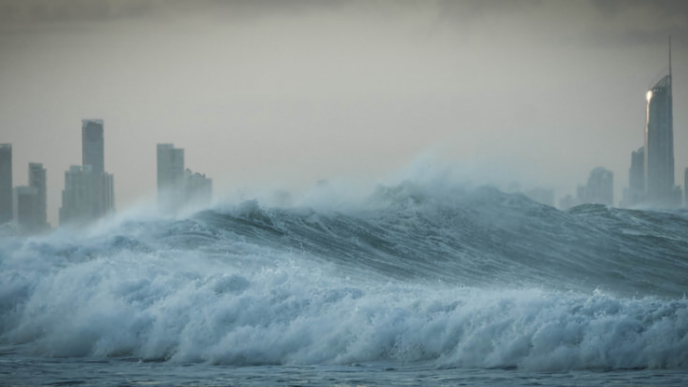
In Alaska, small tsunami waves measuring under a foot above tide level were observed in Sand Point, Old Harbor, King Cove, Kodiak, Unalaska and Alitak Bay, according to the US National Tsunami Warning Center (NTWC).

There were no immediate reports of injuries or damage to property. Several Alaskan coastal communities were evacuated following the quake. Among them was Seward on the Kenai Peninsula, south of Anchorage, where sirens blared and residents were told to move to higher ground.

The US Geological Survey (USGS) said the quake, which struck at 10:15 p.m. local time, was at a depth of 35 km (21.7 miles). It struck about 91 km east-southeast of Perryville, about 800 km (500 miles) from Anchorage, Alaska’s biggest city.

(Read more from “Pacific Tsunami Warnings Lifted After 8.2-Magnitude Earthquake Hits Alaska” HERE)

Delete Facebook, Delete Twitter, Follow Restoring Liberty and Joe Miller at gab HERE.

Watch: Tsunami Sweeps Away Boy Band During Performance in Indonesia

Jaw-dropping footage emerging Sunday shows a giant tsunami wave sweeping away a boy band mid-performance in Indonesia.

Crowds can be seen in the shocking video swaying along to a beach-side Saturday performance by the rock band Seventeen — seconds before the natural disaster hits, engulfing the stage.

Loud shrieks can be heard before the 11-second video goes dark.

The band confirmed that their bassist M Awal Purbani, guitarist Herman Sikumbang and their road manager Oki Wijaya were dead.

(Read more from “Watch: Tsunami Sweeps Away Boy Band During Performance in Indonesia” HERE)

Follow Joe Miller on Twitter HERE and Facebook HERE.

Scientists Solve 50-Year-Old Mystery of Alaska Tsunami

For 50 years, scientists struggled to understand what sparked a devastating tsunami that leveled a remote village in Alaska following the 1964 Great Alaska Earthquake.

But thanks to detailed seafloor images, they have solved the mystery. Scientists from the U.S. Geological Survey now believe a series of underwater landslides as deep as 1,150 feet were responsible for the massive waves that swept through the village of Chenega in Prince William Sound in 1964, destroying all but two buildings and killing 23 people.

Nine people died in Anchorage, Alaska’s largest city, from the 9.2 magnitude quake, the second largest in recorded history, according to the Associated Press. The earthquake caused a trans-ocean tsunami that brought waves to the Alaskan towns of at devastated Valdez, Seward and Whittier and down the West Coast. Four campers on a beach died at Newport, Oregon. A dozen died in the Northern California community of Crescent City.

“It is exciting to see the technology evolve so we can now get high-resolution images of the seafloor that we could not back then and to pinpoint the most likely source for the waves. After 50 years, this new work confirms our original inference that it was probably landslide-generated waves that devastated Chenega so many years ago, but we had no adequate submarine data to define either the size or location of the landslide sources,” USGS geologist emeritus George Plafker who, with colleague Larry Mayo, was one of the first responders and wrote some of the early geological field reports on surface effects of the Chenega waves in 1965, said in a statement. (Read more from “Scientists Solve 50-Year-Old Mystery of Alaska Tsunami” HERE)

Follow Joe Miller on Twitter HERE and Facebook HERE.

3 Dead After Strong Quake Rattles Chile Capital, Causing Some Tsunami Flooding

89e483b3-ef05-477b-8a3d-858c0a3c8a37-2060x1236A powerful magnitude-8.3 earthquake hit off Chile’s northern coast Wednesday night, causing buildings to sway in the capital of Santiago and bringing flooding from small tsunami waves in some shore towns . . .

Authorities had issued a tsunami alert for Chile’s entire Pacific coast, and the tremor was so strong that people on the other side of the continent, in Buenos Aires, Argentina, reported feeling it.

Numerous strong aftershocks, including one measuring 7.0 magnitude and three above 6, rattled the region after the first major tremor since a powerful quake and tsunami killed hundreds in 2010 and leveled part of the city of Concepcion in south-central Chile. (Read more from “3 Dead After Strong Quake Rattles Chile Capital, Causing Some Tsunami Flooding” HERE)

Follow Joe Miller on Twitter HERE and Facebook HERE.

Asia Marks 10th Anniversary of Worst Natural Disaster in Modern History

tsunamiBeachside memorials and religious services were held across Asia on Friday to mark the 10th anniversary of the Indian Ocean tsunami that left more than a quarter million people dead in one of modern history’s worst natural disasters.

The devastating Dec. 26, 2004 tsunami struck a dozen countries around the Indian Ocean rim. It eradicated entire coastal communities, decimated families and crashed over tourist-filled beaches the morning after Christmas. Survivors waded through a horror show of corpse-filled waters . . .

The disaster was triggered by a 9.1-magnitude earthquake, the region’s most powerful in 40 years, that tore open the seabed bed off of Indonesia’s Sumatran coast, displacing billions of tons of water and sending waves roaring across the Indian Ocean at jetliner speeds as far away as East Africa. . .

More than 160,000 people died in Indonesia, more than half of the total 230,000 people killed across the region. . .

In Sri Lanka, the water swept a passenger train from its tracks, killing nearly 2,000 people in a single blow. A symbolic recreation of the train journey was planned as part of Friday’s ceremonies.

Read more from this story HERE.

Tsunami Study Finds Southern California at Risk

Photo Credit: AP

Photo Credit: AP

A large tsunami hitting California would cause major flooding in Long Beach and parts of Orange County and force 750,000 people to evacuate coastal areas in just a few hours, according to an extensive simulation published Wednesday by the U.S. Geological Survey.

The study, released two years after a tsunami killed thousands in Japan, identified several communities that are particularly vulnerable to flooding because of their low elevation and lack of protection from waves.

They include Marina del Rey and the ports of Los Angeles and Long Beach as well as the low-lying coastal areas extending from the ports to Newport Beach.

The report, compiled by dozens of scientists, emergency responders and industry representatives, is the most extensive examination of what a tsunami would do to California’s coastline. The research simulated a 9.1 quake off the Alaska coast that would send damaging waves to California.

While waves would be larger in Northern California — between 10 and 23 feet — the damage could be greater in Southern California because the region has more coastal development and fewer coastal cliffs.

Read more from this story HERE.

Massive, Very Shallow Earthquake Hits Just 66 miles from Craig, Alaska; Tsunami Warning Issued


At just two minutes before 12 a.m. this morning, Alaska time, a massive earthquake hit only 66 miles west of Craig, Alaska.

Initially, the United States Geological Service measured the quake at 7.7 magnitude, but this was later adjusted to 7.5 magnitude.

According to the United States Geological Service, the earthquake was at a very shallow depth of 6.1 miles. However, the National Oceanic and Atmospheric Administration reported the earthquake’s depth at 3.11 miles.

Although the earthquake struck 212 miles south of Juneau, one resident – Alicé Leuchte – stated that it “scared the hell out of me.” Ms. Leuchte added that the people she knew in Craig “are OK.”

So far, there are no reports of serious damage.

The 7.5 magnitude earthquake is apparently related to the Queen Charlotte fault system that apparently spawned the 7.7 magnitude earthquake that struck near Metlakatla last October.

The Tsunami Warning Center in Palmer, Alaska stated at 12:30 a.m. this morning that a “Tsunami warning remains in effect . . . for the coastal areas of British Columbia and Alaska from the north tip of Vancouver Island, British Columbia to Cape Suckling, Alaska.” Cape Suckling is just 75 miles southeast of Cordova, or almost 250 miles southeast of Anchorage.

UPDATE: The tsunami warning has been lifted.

USGS: Massive 7.7 Earthquake Just 164 Miles South of Metlakatla, AK, Tsunami Warnings Issued

An hour ago, a massive 7.7 quake hit near the southern tip of Southeast Alaska, just 164 miles south of Metlakatla.

The United States Geological Survey (USGS) announced that the depth of the quake was approximately 17 kilometers (almost 12 miles).

This is the largest earthquake in the region in 63 years. In 1949, a magnitude 8.1 earthquake struck the area.

The West Coast and Alaska Tsunami Warning Center has issued a regional tsunami warning for areas near the quake, including southeast Alaska. Hawaii is expected to experience some “non-destructive” sea level changes later tonight as a result of the quake.

UPDATE: Tsunami warnings were downgraded to advisories. In Craig, Alaska, the earthquake apparently caused a four inch wave. Despite the significant size of the earthquake, relatively minor damage has been reported from Canada and southeast Alaska.