
Winter Storm Poised To Bring Snow and Ice to the Northeast Christmas Night
Holiday travelers across the Northeast can expect relatively smooth conditions heading into Christmas — but forecasters warn a fast-moving winter storm is lining up to bring snow, ice and hazardous roads shortly afterward.
Meteorologists with the FOX Forecast Center say a brief window of calm weather will give way to a wintry mix beginning Christmas night and continuing into Saturday. While the exact track of the storm is still taking shape, confidence is growing about the timing and potential impacts across several states.
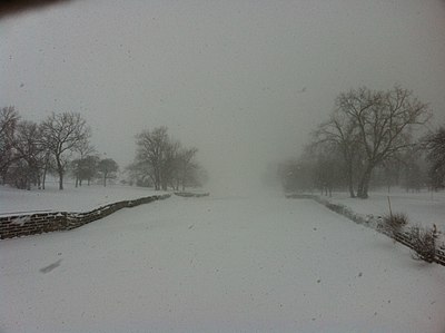
The system is expected to spread rain, snow and freezing rain across the region starting Friday, with the most active period lasting into early Saturday. Snow accumulation is likely from the Catskills and Poconos through parts of the tri-state area, including New York City and portions of New Jersey and Connecticut.
QUICK-HITTING WINTER STORM is likely in the Northeast right after Christmas, with heavy snow and ICE being a possibility!
Areas like New York City, Washington DC, and Buffalo will likely be affected by this. pic.twitter.com/ZxFzlfGHn4
— Max Velocity (@MaxVelocityWX) December 23, 2025
Preliminary projections suggest many communities from central New Jersey through NYC and southern Connecticut could pick up around 3–5 inches of snowfall, with some localized totals possibly reaching 5–8 inches depending on how long colder air lingers.
As the storm approaches, Winter Weather Advisories or Winter Storm Warnings are considered likely.
A strong high-pressure system over Quebec is also contributing to an elevated risk of icing — particularly in central Pennsylvania — where forecasters say ice accumulation could reach one-tenth to one-quarter of an inch. A few isolated pockets may see even more, which could trigger scattered power outages and slick, dangerous roads.
Areas from State College, Pennsylvania, extending south toward Frederick, Maryland, are currently highlighted as zones with the greatest potential for impactful ice. Drivers in those regions may face treacherous conditions from Friday afternoon through early Saturday morning.
The good news: the system is expected to move quickly. Road conditions should begin improving by Saturday afternoon as precipitation tapers off and crews work to clear affected areas.
However, the break may be brief. Forecasters are already monitoring another storm system projected to swing through the Northeast late in the weekend and into early next week, potentially bringing another round of rain and snow in the days leading up to New Year’s Eve.
Residents are encouraged to monitor local forecasts, prepare for possible travel disruptions, and stay alert for updated advisories as the storm path becomes clearer.

