Posts

Terrifying Plea in Midst of Florence Devastation Saves 3 Generations Trapped in Attic

By Conservative Tribune. Social media can be a major distraction in today’s world. Platforms like Facebook and Twitter seem to be magnets for trashy posts and endless arguments these days … But sometimes, the power of online communication ends up saving lives.

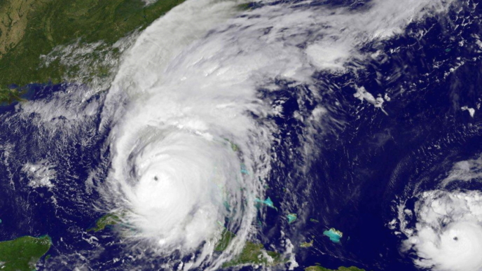
A last-resort Twitter post from one woman in North Carolina may have just prevented a tragedy. As flood waters rose during Hurricane Florence, Breeanna Perry used the social media platform to make sure that she, along with her mother and grandmother, could be found. . .

Perry said that she and her family had a difficult time evacuating because her mother is disabled and her grandmother is elderly. They made the decision to stay in their home to ride out the storm — and at first, everything seemed fine. . .

“I actually put my feet on the ground to go talk to my mom, and I start being shocked,” she said. “I realized there was water on the ground and we had to turn the power off and after that the water was just coming in within minutes.”

As her phone was running out of battery, Perry posted a tweet with her location and situation. (Read more from “Terrifying Plea in Midst of Florence Devastation Saves 3 Generations Trapped in Attic” HERE)

_________________________________________

Woman Trapped by North Carolina Floodwaters Is Rescued Along With Her Mom and Grandmother After Tweeting a Desperate SOS From Their Attic

By Daily Mail. Local emergency services were swamped with other cases in the deadly hurricane that has claimed 15 lives in the state so far, but eventually her Tweet went viral and got the attention of the Cajun Warriors.

‘If anybody could help… our cars is under water and so is our house stuck in attic. Phone about to die please send help to [redacted], new bern. NC,’ Perry – who graduated high school last summer – wrote. The message has been retweeted over 11,000 times.

‘I sent the tweet, I didn’t expect it to go viral,’ ‘I came back in the house, we still had power, and everything, every body was okay, we were just in our rooms watching TV,’ Perry told Fox Denver 31. . .

Perry and her relatives were eventually rescued at 6am that morning and walked half an hour down the road to reach evacuation buses. Kite later shared that the family had been brought to safety. (Read more from “Woman Trapped by North Carolina Floodwaters Is Rescued Along With Her Mom and Grandmother After Tweeting a Desperate SOS From Their Attic” HERE)

Follow Joe Miller on Twitter HERE and Facebook HERE.

Eerie Video Shows Hurricane Whip, Beat, Rip American Flag That Refuses to Give Up

As Hurricane Florence was barreling toward the Carolinas on Thursday, one of the most dramatic displays of the storm’s power was the Frying Pan Tower webcam.

The Frying Pan Tower is a former Coast Guard lighthouse that also served as a housing platform.

Nowadays, it serves a significantly different purpose. According to its website, the tower has “been turned into a unique adventure bed & breakfast like no other” and serves as a nonprofit, kept alive by donations.

It’s located roughly 30 miles off the North Carolina coast, where visitors can visit the Atlantic Ocean’s most interesting B&B (for all I know, it’s the only one) by boat.

On Thursday, however, the only visitor was Florence, whose fury was captured on the Frying Pan Tower webcam.

As you can see from the above footage, the American flag that hangs above the rig took quite a beating — but, like the flag from Francis Scott Key’s most famous work, it was still there. It might have been whipped and beaten by the winds and the rain, but the stars and stripes still held on as the storm gave it all it had.

It’s worth noting that the Flag Code advises that Old Glory “should never be fastened, displayed, used, or stored in such a manner as to permit it to be easily torn, soiled, or damaged in any way.” Hurricanes certainly qualify under the aegis of that.

However, it’s also worth noting that on an offshore lighthouse-turned-hotel, there are more significant things that need to be done in order to ensure the safety of everyone involved. This includes getting everyone off the rig as soon as possible without necessarily following the Flag Code to the letter.

Florence was downgraded to Category 1, but that doesn’t mean it wasn’t a potent storm, as the video clearly evinces. For residents of the Carolinas, many of whom have seen a massive storm surge and over 20 inches of rain in some places, the danger isn’t past. The threat from flooding lingers.

This isn’t the first time that a flag has gone viral during a hurricane. Back in 2017, Martin County, Florida, Sheriff’s Deputy Lt. Danny Cunningham became a national name after he rescued a wind-battered flag during Hurricane Irma.

“I couldn’t watch it get blown apart,” Cunningham was quoted as saying.

During Hurricane Harvey, Texas police Officer Jack McCarty became a viral sensation for a similar reason.

To those who have felt Hurricane Florence’s wrath, our thoughts and prayers are with you. Hang in there — like the flag at the Frying Pan Tower. (For more from the author of “Eerie Video Shows Hurricane Whip, Beat, Rip American Flag That Refuses to Give Up” please click HERE)

Follow Joe Miller on Twitter HERE and Facebook HERE.

‘Monster’ Florence Aims to Drench Carolinas as Waves Within Hurricane More Than 80 Feet High

By CBS Local. Coastal residents fleeing a potentially devastating blow from Hurricane Florence encountered empty gasoline pumps and depleted store shelves as the monster storm neared the Carolina coast with 125 mph winds and drenching rain that could last for days.

The hurricane was downgraded to a Category 2 on Wednesday evening, but it is still a large and dangerous storm. As of 11 p.m., the storm was centered 280 miles southeast of Wilmington, North Carolina, and was moving northwest at 17 mph.

But the National Hurricane Center said Wednesday evening that the storm is expected to bring life-threatening storm surge and rainfall to the Carolinas as it approaches the coast Thursday and Friday.

The National Hurricane Center’s Tropical Analysis and Forecast Branch said waves within the hurricane were more than 80 feet high.

“Wave heights to 83 ft were measured early this morning under the NE quadrant of Hurricane Florence. These enormous waves are produced by being trapped along with very strong winds moving in the same direction the storm’s motion,” the branch said earlier Wednesdayfge. (Read more from “‘Monster’ Florence Aims to Drench Carolinas as Waves Within Hurricane More Than 80 Feet High” HERE)

____________________________________________

83-Foot Wave Recorded by Satellite Monitoring Hurricane Florence

By CBS Local. A National Weather Service satellite monitoring Hurricane Florence has recorded a wave reaching 83 feet in the storm churning in the Atlantic Ocean.

That’s more than eight stories tall, for reference.

A satellite altimeter under the northeast quadrant, the strongest area of the storm, recorded the wave. It ranged 59 to 83 feet Wednesday morning. (Read more from “83-Foot Wave Recorded by Satellite Monitoring Hurricane Florence” HERE)

Follow Joe Miller on Twitter HERE and Facebook HERE.

1 Million Flee Hurricane Florence

Hurricane warnings were issued Tuesday afternoon as ferocious Hurricane Florence marched relentlessly toward the U.S. East Coast, a massive storm threatening record rains and historic flooding as more than 1 million people flee the anticipated devastation. . .

As of 5 p.m. ET Tuesday, the National Hurricane Center issued hurricane warnings for portions of the South and North Carolina coasts as the 140-mph Category 4 storm crawled closer to shore.

The first rain bands could reach the Carolinas and Virginia on Wednesday, forecasters said. Hurricane-force winds could reach the mainland by Thursday evening. North Carolina was the most likely target for landfall, but states of emergency were also declared in South Carolina, Virginia, Maryland and Washington, D.C.

At 140 mph, Florence is now a Category 4 storm out of a possible Category 5 on the Saffir-Simpson hurricane wind scale. The hurricane center warned that the storm would strengthen and be an “extremely dangerous, major hurricane” through Thursday. . .

The storm was about 785 miles east-southeast of Cape Fear, North Carolina, heading west-northwest at 17 mph. Florence was forecast to roll across the southwestern Atlantic between Bermuda and the Bahamas through Wednesday before approaching the coast of North Carolina or South Carolina on Thursday or Friday. (Read more from “1 Million Flee Hurricane Florence” HERE)

Follow Joe Miller on Twitter HERE and Facebook HERE.

Powerful Hurricane Looms in Pacific, Could Be First of 2018 to Hit U.S.

A powerful and rare storm is brewing in the Pacific Ocean and threatens to hit one Hawaiian island for the first time in more than a quarter of a century.

According to Fox News, Hurricane Lane was identified this week about 450 miles to the south-southeast of Kailua-Kona, which is located on the big island of Hawaii.

The Central Pacific Hurricane Center issued an advisory Tuesday morning, describing the storm as a Category 4 hurricane with sustained winds as high as 150 miles per hour.

It was moving at about 12 miles per hour at the time of the report and is expected to weaken as it heads toward possible landfall.

“Hurricane conditions are possible within the Hurricane Watch area on Thursday,” according to the advisory. “Excessive rainfall associated with Lane is expected to affect portions of the Hawaiian Islands on Wednesday into the weekend, leading to flash flooding and landslides.”

Both Hawaii and Maui counties have been added to the hurricane watch region. Whether Lane remains a hurricane or is downgraded to a tropical storm, experts say it could wreak havoc on the island state.

Fox News Senior Meteorologist Janice Dean said forecasts show the storm heading “very close” to land, but as of the latest reports it was unclear which path it would take.

“What is uncertain is the exact track and how strong the system will be as it approaches land,” she said.

The meteorologist noted how uncommon landfall in this area of the U.S. is, explaining only three have hit Kauai in recorded history. The latest was in 1992 with Hurricane Iniki. Hurricanes Iwa and Dot preceded it in 1982 and 1959, respectively.

In a tweet on Tuesday, the National Weather Service in Honolulu announced a flash flood watch would be in effect for 28 Hawaii counties from 6 a.m. Wednesday to 6 p.m. Friday.

Local officials are similarly expressing caution and advising preparation ahead of the storm’s arrival later this week.

“Some people might say, ‘Another hurricane, it didn’t hit us last time. We don’t need to worry,’” Honolulu Mayor Kirk Caldwell said.

Instead, he said Hawaiians have “got to plan for the worst and hope for the best.”

Maui’s mayor agreed.

“Anyone who is waiting until the storm hits to prepare will find themselves running around at the last minute and standing in line at the gas stations and grocery stores,” Alan Arakawa advised. “So prepare now and avoid being on the road when you should be safe at home.” (For more from the author of “Powerful Hurricane Looms in Pacific, Could Be First of 2018 to Hit U.S.” please click HERE)

Follow Joe Miller on Twitter HERE and Facebook HERE.

Hurricane Season May Not Be Over Yet

By Doyle Rice. The 2017 Atlantic hurricane season may not be over yet.

An area of showers and thunderstorms now spinning in the western Caribbean has a 50% chance of developing into Tropical Storm Philippe by the weekend, the National Hurricane Center said.

The disturbance is likely to drift across the northwestern Caribbean into Friday, then across the Florida Straits and part of South Florida on Saturday, according to AccuWeather meteorologist Dan Kottlowski.

On Sunday, it’s likely to take a path parallel to the Atlantic coast of the U.S., he added. (Read more from “Hurricane Season May Not Be Over Yet” HERE)

_______________________________________________

When Hurricanes Hit: The Biggest Threat Is Right Now

By Brett Clarkson. At this time of year, when a storm forms, it’s more likely to hit us.

That’s because October storms are more likely to form in the western Caribbean Sea, where they tend to travel north over or near western Cuba and then across southern Florida.

That’s what Hurricane Wilma did in 2005 — exactly 12 years ago Tuesday. And now, forecasters are saying there’s a 50 percent chance a smattering of rainstorms in the western Caribbean will become at least a tropical depression in the next five days.

“We’re in a wait and see mode,” said Dennis Feltgen, spokesman for the Miami-based National Hurricane Center. (Read more from “When Hurricanes Hit: The Biggest Threat Is Right Now” HERE)

Follow Joe Miller on Twitter HERE and Facebook HERE.

New Orleans Orders Evacuations Ahead of Hurricane Nate

The U.S. Gulf Coast braced Friday for a fast-moving blast of wind, heavy rain and rising water as deadly Tropical Storm Nate threatened to reach hurricane strength before a weekend landfall.

New Orleans Mayor Mitch Landrieu on Friday ordered an evacuation of some areas and a mandatory curfew ahead of Nate.

The curfew will be in effect from Saturday evening to Sunday morning, the mayor said at a news conference.

Alabama, Florida, Louisiana and Mississippi declared states of emergency as the storm twisted toward the U.S. Gulf Coast on Friday after killing at least 22 people in Central America. (Read more from “New Orleans Orders Evacuations Ahead of Hurricane Nate” HERE)

Follow Joe Miller on Twitter HERE and Facebook HERE.

Hurricane Jose’s Path Is Uncertain as It Lingers off the Atlantic Coast

Hurricane Jose has weakened to a Category 1 storm, but its ultimate path and strength are uncertain as it lingers over the Atlantic Ocean.

Jose, which followed on the heels of Hurricane Irma, passed north of the Caribbean islands and Puerto Rico as a Category 4 storm on Sunday.

According to the National Hurricane Center, the storm is currently “moving slowly eastward with little change in strength,” and “will remain well to the east-northeast of the Bahamas through Wednesday.”

The storm has maximum sustained winds of 75 mph.

“Hurricane-force winds extend outward up to 25 miles (35 km) from the center and tropical-storm-force winds extend outward up to 140 miles (220 km),” the NHC said.

There are no hurricane watches or warnings for the storm in effect for the U.S. at this time.

Americans await Jose’s future as the recovery from Irma is getting underway.

Irma, one of the most powerful storms in recorded history left a path of extensive destruction, but experts noted it could have been far worse.

Still, Irma has taken the lives of at least 12 people in the U.S. including seven in Florida, three in Georgia and two in South Carolina, according to ABC News.

The Florida Keys faced the brunt of the storm as it made landfall in the U.S.

The Federal Emergency Management Agency said Tuesday that 25 percent of the homes in the Keys were destroyed.

“Basically, every house in the Keys was impacted some way,” FEMA Administrator Brock Long said.

According to the Department of Homeland Security, 15 million Floridians remained without power on Tuesday. (For more from the author of “Hurricane Jose’s Path Is Uncertain as It Lingers off the Atlantic Coast” please click HERE)

Follow Joe Miller on Twitter HERE and Facebook HERE.

Florida-Bound Hurricane Irma Back to Category 5

Hurricane Irma strengthened back into a Category 5 storm Friday night as it made landfall on the Camaguey Archipelago of Cuba with maximum sustained winds of 160 mph, according to the National Hurricane Center.

Irma’s status as a Category 4 storm was relatively short-lived, having been downgraded from a Category 5 storm early Friday morning.

As of 11 p.m. ET, Irma was about 300 miles from Miami and moving about 13 mph toward the west, the National Hurricane Center said.

Hurricane Irma remains forecast to hit the Florida Keys as a Category 5 storm.

(Read more from “Florida-Bound Hurricane Irma Back to Category 5” HERE)

Follow Joe Miller on Twitter HERE and Facebook HERE.

Tips on Last-Minute Hurricane Prep From an Expert

Jeffrey Yago, a certified energy professional with more than 40 years of experience in the energy and emergency power field, told WND it’s too late at this point for Americans in Irma’s path to prepare any major backup power systems for their homes in case the power gets knocked out. However, he said there are still measures people can take to prepare.

“I would certainly be scooping up all the batteries I could find,” he advised. “That would be the No. 1 thing. They want to think about maybe some larger LED yard lights. Those are rechargeable and people can put them outside in the daytime to charge up and then use them at night. I don’t think people will be thinking about yard lights right now, so they might still be available.”

Yago goes into detail about how to charge and install LED yard lights, as well as how to replace essentially any grid-powered device with a battery-powered one, in his informative do-it-yourself manual “Lights On: The Non-Technical Guide to Battery Power When the Grid Goes Down.” . . .

Therefore, people need to assume the burden of preparation themselves, according to Yago. And their biological needs must be the top priority.

“I think people right now need to think in terms of they may not have any help, at least not for days, and drinking water is going to be the No. 1 priority,” Yago said. “I think a lot of people are going to be evacuating, so there’s all kinds of water purification bottles available, and I carry one in every car I have. It’s about a quart-sized bottle that has a water filter in it, and you can scoop the water right out of a gutter and it makes it 100 percent pure to drink.” (Read more from “Tips on Last-Minute Hurricane Prep From an Expert” HERE)

Follow Joe Miller on Twitter HERE and Facebook HERE.