
California Could Go Through All of February Without a Significant Rain Storm for the First Time Since 1864. a Photo From Space Reveals Why.
February should be the heart of California’s rainy season — but this month, there’s no rain.
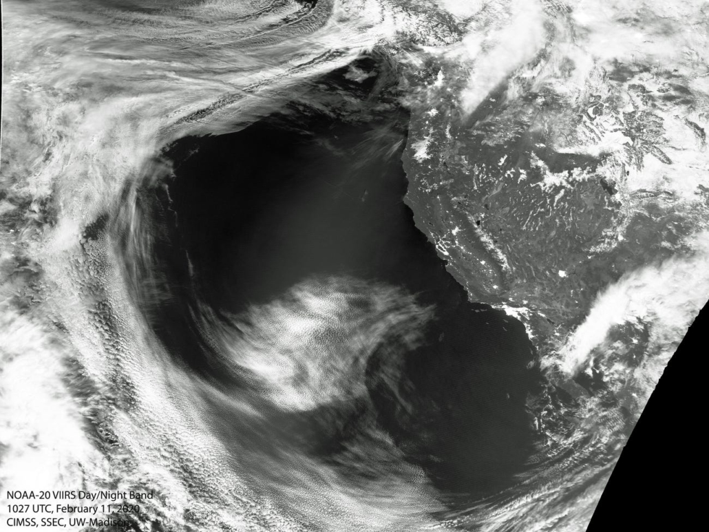
The image above, taken by a National Oceanic and Atmospheric Administration (NOAA) satellite on February 11, offers a visual explanation for the weird weather.
The photo shows a giant high-pressure ridge over the Pacific Ocean that’s keeping storm clouds away from the California coast. The ridge is sending that wind and rain towards the Pacific Northwest instead. . .

Margaret Mooney, education director at CIMSS, told Business Insider that this is “an unusual, persistent weather pattern that’s working against California right now.”
The ridge is the edge of a warmer, high-pressure system that began mid-January. Meteorologists expect it to continue for the rest of the month. If February ends without a significant storm in California (high winds and heavy rain or snowfall), it would be the first time in over 150 years that the month is dry. (Read more from “California Could Go Through All of February Without a Significant Rain Storm for the First Time Since 1864. a Photo From Space Reveals Why.” HERE)
Follow Joe Miller on Twitter HERE and Facebook HERE


